Highway Map
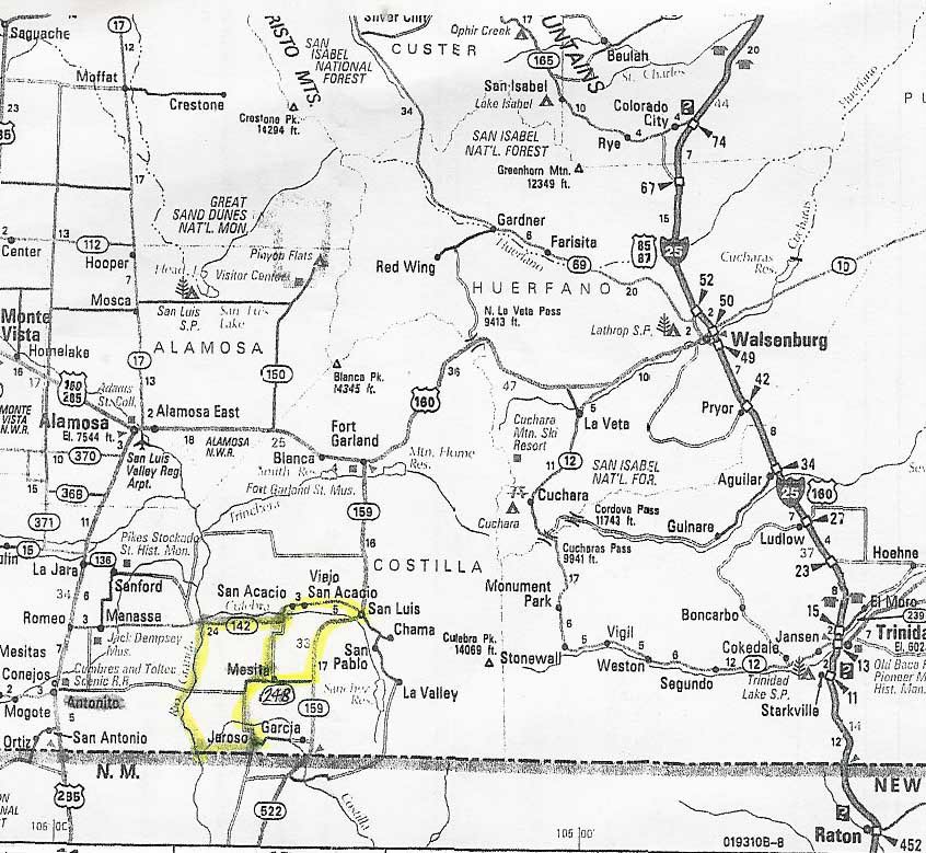 This map shows Hwy 142 flanking the northern boundary of Rio Grande Ranchos with Hwy 248 running through the center of the subdivision, connecting the area Hwy 285 on the east near the town of Antonito and the Scenic Rail Road. From this junction, Hwy 285 heads north to the San Luis Valley Airport and the town of Alamosa. (Click to enlarge.) The Rio Grande River runs along the eastern boundary of Rio Grande Ranchos.
posted by ProsperityWest @ 7:23 PM
![]()
![]()